Imelda Moves Inland, Dumping Inches in Texas

[Stay on top of transportation news: Get TTNews in your inbox.]
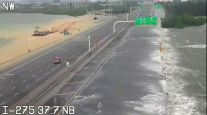
Imelda is threatening to dump up to 18 inches of rain in parts of Southeast Texas and southwestern Louisiana as the tropical depression moves inland over the next few days.
Jeff Lindner, a meteorologist and director of flood operations for the Harris County Flood Control District in Houston, said the main threat from Imelda remained the potential for heavy rainfall and flooding.
“We have a few things in our favor. The ground is dry. It’s been dry for a while here as we’ve come through summer,” Lindner said Sept. 17. “The initial parts of this rainfall will go toward saturating the ground.”
WANT MORE NEWS? Listen to today's Daily Briefing
Ken Graham, director of the National Hurricane Center, said the Houston area and parts of the upper Texas coast and East Texas could get significant rainfall through Sept. 19 as the storm moves north. Imelda’s rain bands were also stretching into Louisiana.
The National Hurricane Center said early Sept. 18 that Imelda had weakened to a tropical depression and was located about 25 miles north-northwest of Houston.
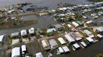
Imelda is the first named storm to impact the Houston area since Hurricane Harvey, according to the National Weather Service. Harvey dumped nearly 50 inches of rain on parts of the flood-prone city in August 2017, flooding more than 150,000 homes in the Houston area and causing an estimated $125 billion in damage in Texas.
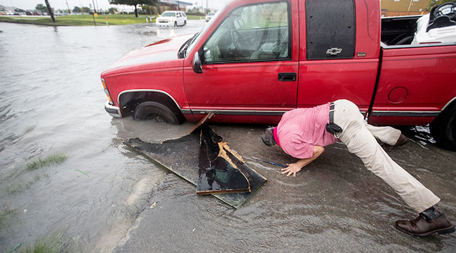
Flooding in parts of south Texas has already started. (Brett Coomer/Associated Press)
While there could be some isolated structure flooding in the Houston area, widespread house flooding from Imelda “doesn’t look likely at this point,” Lindner said.
However, he said residents who live in flood-prone areas should still be mindful and take extra precautions.
Officials in the Houston area were preparing high-water vehicles and staging rescue boats Sept. 17.
The storm, which formed Sept. 17, made landfall near Freeport, Texas, with maximum sustained winds of 40 mph. Some parts of Harris County and neighboring Galveston County had already received about 4 inches of rain through the afternoon of Sept. 17.
Many schools in the Houston and Galveston area canceled classes Sept. 18 because of the storm.
In a Sept. 17 tweet, Houston Mayor Sylvester Turner asked residents to be “alert and weather aware.”
Gov. Greg Abbott on Monday placed numerous resources on standby across Texas. The Texas Division of Emergency Management will be rostering four boat squads in coastal areas. The Texas Parks and Wildlife Department will be moving boats to support the Beaumont area and adjacent regions.
Meanwhile, the National Hurricane Center said Hurricane Humberto in the Atlantic Ocean is posing a stronger threat to Bermuda. The Category 3 hurricane with maximum sustained winds of 115 mph was about 240 miles from Bermuda on Sept. 18. Tropical Storm Jerry became the 10th named storm of the Atlantic hurricane season, though it remained far from land. Meteorologists also said newly formed Tropical Storm Lorena in the Pacific Ocean could produce heavy rains and flooding in Mexico by Sept. 19.