Hurricane Warning for New Orleans as Zeta Swirls Over Mexico

[Ensure you have all the info you need in these unprecedented times. Subscribe now.]
CANCUN, Mexico — Storm-weary Louisiana is once again under a hurricane warning, with Zeta leaving Mexico’s Yucatan Peninsula on a path that could hit New Orleans the night of Oct. 28.
Zeta, the 27th named storm in a very busy Atlantic season, made landfall as a hurricane just north of the ancient Mayan city of Tulum with maximum sustained winds of 80 mph (130 kph). It weakened to a tropical storm as it crossed over land, but it was expected to regain strength over the Gulf of Mexico.
Zeta’s top winds were 70 mph (110 kph) early Oct. 27, and it was centered about 540 miles (865 kilometers) south of the mouth of the Mississippi River. If Zeta makes landfall in Louisiana, it will be the fifth named storm to hit the state this year, joining Cristobal, Laura, Marco and Delta.
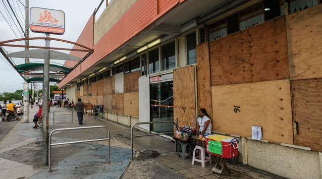
A woman waits outside a supermarket with plywood-covered windows in Cancun, Mexico, Oct. 26. (Victor Ruiz Garcia/Associated Press)
Zeta was still drenching the northern Yucatan as its center moved over the water. Quintana Roo state Gov. Carlos Joaquín said via Twitter early Oct. 27 that early reports indicated his state suffered no major damage, nor were there reports of deaths or injuries. He said airports were open and business activity could resume Tuesday morning, though beaches would remain closed until the surf calms.
In Playa del Carmen, between Tulum and Cancun, Mexican tourist Elsa Márquez held up her beach towel Monday so it flapped in the wind, rattling with the strong gusts Monday a few hours before Zeta’s arrival.
“This is our first experience (in a hurricane) and the truth is we are a little afraid because we don’t know what will happen, but here we are,” said Márquez, who was visiting the resort from the north-central state of Queretaro.

Over the past few episodes, we've had the chance to listen to the experiences of industry leaders and the strategies and planning that go into finding the right people for your workforce. Host Michael Freeze reviews the most important bullet points, from technician and driver training to incorporating diversity in recruitment and retention. Hear a snippet, above, and get the full program by going to RoadSigns.TTNews.com.
Another tourist, Mario Ortiz Rosas from the western state of Michoacan, looked at the rising waves, noting: “I didn’t plan for this, but it looks like it is going to get complicated.”
Some boats that normally carry tourists in Cancun took refuge in a nearby lagoon channel, anchored among the mangroves to avoid the battering wind, waves and storm surge. Boat captain Francisco Sosa Rosado noted they had to perform the same maneuver barely three week ago, when the area was hit by a stronger Hurricane Delta, which made landfall with top winds of 110 mph (175 kph).
“With Delta, the gusts of wind were very strong ... the anchor lines were at risk of breaking,” Sosa Rosado said. “I hope it won’t be as bad with this hurricane.”
RELATED: Tropical Storm Zeta Threatens Mexican Resorts, Louisiana
Quintana Roo state officials reported nearly 60,000 tourists in the state as of midweek.
Zeta broke the record for the previous earliest 27th Atlantic named storm that formed Nov. 29, 2005. It’s also the 11th hurricane of the season. An average season sees six hurricanes and 12 named storms.
There have been so many storms this season that the hurricane center had to turn to the Greek alphabet after running out of assigned names.
Zeta is the furthest into the Greek alphabet the Atlantic season has gone. There was also a Tropical Storm Zeta in 2005, but that year had 28 storms because meteorologists later went back and found they missed one, which then became an “unnamed named storm.”
Want more news? Listen to today's daily briefing:
Subscribe: Apple Podcasts | Spotify | Amazon Alexa | Google Assistant | More