Ohio Project Will Use Drones to Monitor Highway Traffic

A three-year, $5.9 million study in central Ohio will use drones to monitor traffic on a 35-mile highway, and provide new information used to prevent crashes between manned and unmanned aircraft.
DriveOhio, a center recently developed within the Ohio Department of Transportation, is tasked with pushing new technologies like autonomous vehicles to improve Ohio’s transportation system. The agency announced plans last week to use unmanned aircraft to monitor traffic and road conditions along the 33 Smart Mobility Corridor, a stretch of highway between Dublin and East Liberty.
“This way we have a more comprehensive picture of modes of transportation,” said Fred Judson, director of the Ohio/Indiana UAS Center located in Springfield.
The UAS center’s mission is to provide a hub for research and testing to advance drone technology for commercialization and looks for ways to integrate the technology into national airspace.
RELATED: Uber to offer food delivery by drone in San Diego
RELATED: Fifty-mile drone flights beckon as industry pushes FAA on rules
The project, set to begin in July, is a partnership between the UAS center and The Ohio State University College of Engineering. It is expected to take 12 months.
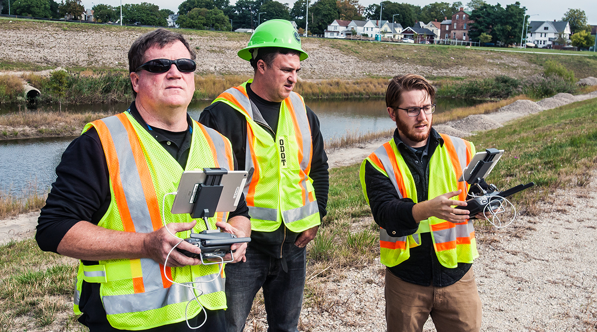
OhioDOT/Flickr
The study will be conducted over five phases, and at the end will provide a plan for possible implementation statewide, Judson said. Drones will monitor traffic along the corridor from the air and transmit data to the Transportation Research Center outside East Liberty, as well as the Ohio Department of Transportation’s central office. The goal is to look for ways to improve efficiency and improve safety.
Along with monitoring traffic, the project also will use sensors and other equipment to make sure the drones don’t collide with any other manned or unmanned aircraft using the low-altitude airspace.
That research could pave the way for commercial uses like drones that deliver packages and air taxi services that could carry people, Judson said.
RELATED: FedEx, Alphabet, Uber win drone sweepstakes; Amazon left out
The 33 Smart Mobility Corridor is a stretch of highway Northwest of Columbus that will be a testbed for autonomous vehicles.
“We’re excited about the project and the focus on the Smart 33 Corridor,” Judson said. “The interactions with that system can lay out the blueprint to use unmanned UAS in a truly commercial way different than any way they’ve been used till now.”
Several other entities, including the Ohio Turnpike Commission and the cities of Dublin and Marysville are also partnering for the project, Judson said.
The Springfield UAS center is also involved in other projects designed to allow businesses and researchers to test unmanned aerial systems beyond the line of sight.
Last year, the UAS Center completed an agreement to connect to a statewide broadband network that will allow the site to connect with the city of Springfield, along with several local colleges and universities. The agreement will assist Ohio’s efforts to connect with researchers to advance drone technologies for a number of industries, local leaders said.
Among other entities, the project made it possible to link the UAS Center in Springfield to Calamityville, a training facility for emergency responders in Fairborn. It is also able to connect to Wright-Patterson Air Force Base and the NASA Glenn Research Center in Cleveland.